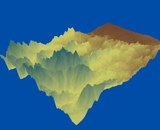
After completing all my maps of hillshade, slope, aspect, and the 3D view of the selected area I was able to find out what the selected area was through the extent coordinates in decimal degrees: top 39.8291666661, left -105.788888889, right -104.969444445, and bottom 39.3838888883. The coordinates gave the selected location as Denver, Colorado. Other information about the coordinate system is the spatial reference is GCS_North_American_1983 and the datum is D_North_American_1983. Overall, this lab was a good way of seeing the different layer of data of a location in ArcMap and ArcScene.


No comments:
Post a Comment