
By looking at these two different projections that have one similar feature, equidistant, we see the differences in viewing maps and the distances between the two cities vary. This goes for all other projections that can vary in equidistant equal area, and conformal. After doing this lab i learned how to select two locations and measure the distance between the two locations.
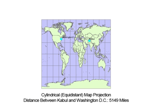
Overall, the different projections show how one's idea of a map or how they measure locations can vary or change how they imagine an area of specific location based on the projection they are viewing. The six different projections can distort the reality of locations and the features they present. Take these two projections, sinusoidal and cylindrical, which both have equidistant. They both appear different and equidistant is one thing that keeps the lines of at same distance, yet the two projections have other common features such as sinusodial keeps the lines parallel, the equator straight, and other meridians curved. While cylindrical is a projection of a surface that lies flat or is a flat plane.